Lesson 1 Maps and Flat Earth

Do maps from history indicate Flat Earth or Globe Earth?
With a bit of careful observation, you will notice that on every one of the following facsimile maps there are what we typically refer to as
longitude (
Meridian Lines - Top to Bottom - North South) and
latitude (
Parallel lines - Right to Left - East to West).
The maps below are facsimiles of originals when they could be found. The remainder are more recent versions of the designing
cartographer’s original concept.
(You can zoom in to some of the maps by visiting the links below the maps where the images were taken from.)
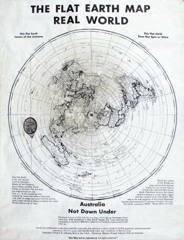
Flat Earth Map - Real World
(Circa 1967 Charles-K-Johnson)
Since the flat Earth view of Earth is somewhat of a minority understanding, there are very few credible projections of the flat Earth concept that were printed as maps. This is one of the few flat Earth maps that was done with a good amount of detail. However, this map was not widely distributed and is rarely seen today.
1
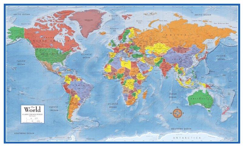
Miller Cylindrical Projection
(1942 Osborn M. Miller)
This map is perhaps the most common map used in schools so far in the 21st century. While very similar to maps 8 and 13 shown below, this map compensates for distortion by compressing the parallels as it nears the North and South.
3
The Science Of God Vol. 1
by R Lindemann
While this book does not specifically discuss flat Earth, it will give you a clear understanding of exactly how Biblical creation would have to transpire and whether or not big bang would be able to be part of that. You will also get a clear view of the time-frames required for creation to occur.
AD
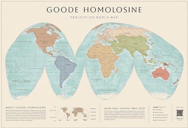
Goode Homolosine Projection
(1923 J. Paul Goode)
Commonly called an “Orange Peel” map, this map is quite accurate regarding actual land proportions compared with most other maps. Its odd configuration allows us to see the entire map in a flat format, but it cuts through some of the land making it slightly more difficult to process when using those portions of the map.
4
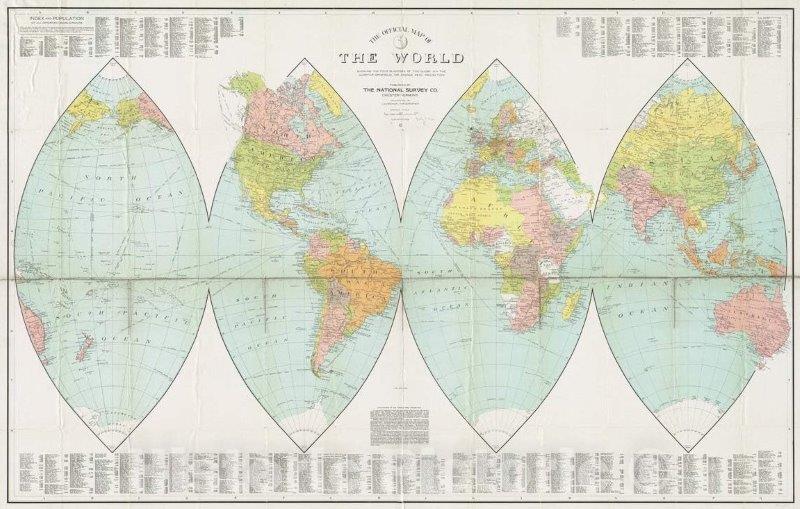 The Official Map of The World(1919 Lawton V. Crocker)
This common Navette style map shows the “four corners” of the earth in a flat format. This map was often found in schools early to mid-1900s. It ranks among the top maps regarding accuracy of land-size-proportion due to its ability to be wrapped around a sphere with little or no overlap.
5
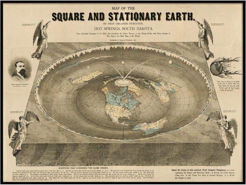
Square and Stationary Earth
(1893 Orlando Ferguson)
This particular map is one the modern seeds of flat Earth. If you visit the link and zoom in you can read the text at the bottom. Its claim is that it is a Biblically based representation. It uses similar meridian and parallel lines as all other maps.
This map is not exactly a “flat Earth” map as it is visibly more of a dish or roulette wheel shape. If the Earth has this particular shape, then logically with a powerful telescope we should be able to see New Zealand from Alaska, or even the Antarctic “ice wall” from anywhere in the world to easily confirm this shape.
6
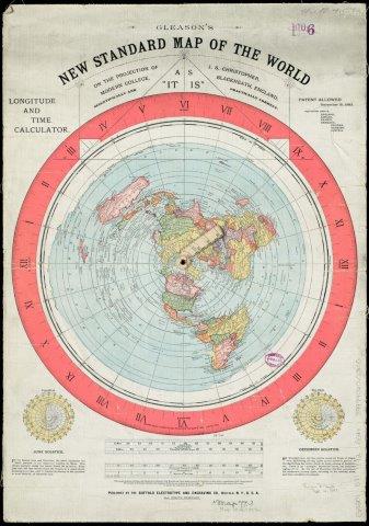
Flat Earth Map of the World
(1892 Alexander Gleason Map)
This map is often considered an accurate map of a flat Earth, and while the map itself doesn not specifically state that it is a flat Earth map like maps 1 and 6 do, the cartographer did make statements with Biblical references indicating that he likely believed that the Earth is flat.
7
The Science Of God Vol. 2
by R Lindemann
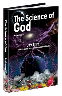
Day three in the Biblical creation account is unique in that it has gathering of waters and the initial appearance of land, and on the same day plants are brought into the picture. The Science of God Volume 2 walks through the requirements for this to occur, and the viability of it as described in the Bible.
AD
Gall-Peters Cylinder Projection World Map
(1855 James Gall)
While very similar to map style 13, this map averages the East to West distortion to where the Equator is compressed and the North and South areas are stretched. While map 13 is most accurate at the Equator, this map is most accurate about 1/4 distance from the bottom, and about 1/4 distance from the top where most of the world’s population resides.
8
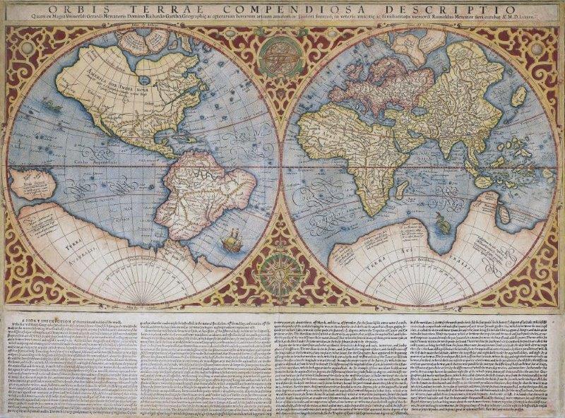
Mercator Orbis Terrae World Map
(1588 Gerardi Mercator)
In this rendition of the Earth, Gerardi Mercator was showing both sides his view of the Earth at the same time. While this does solve the problem of viewing an entire sphere at a glance, it also suffers from substantial land size distortion.
11
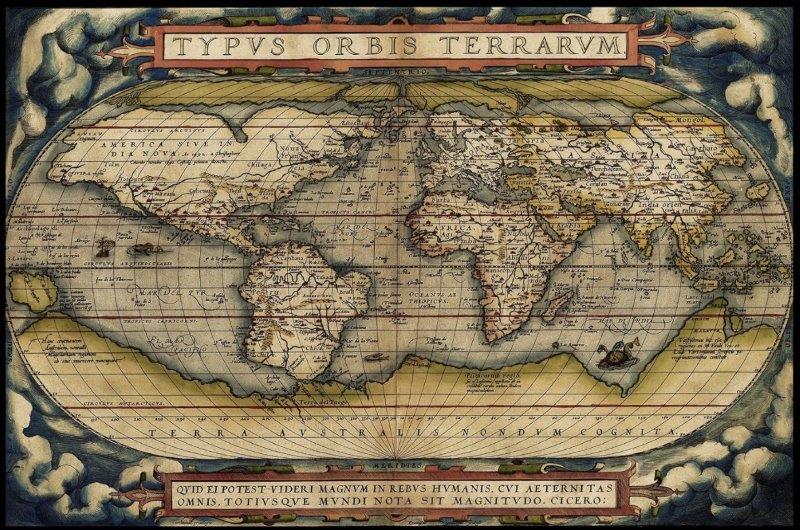
World Map
(1570)
This style world map is the basis for map 2. Regarding at-a-glance viewing, it is the most practical type of map. Notice the Latin map title “ORBIS TERRARVN” or Orb Terra or Spherical Earth
12
The Science Of God Vol. 5
by R Lindemann
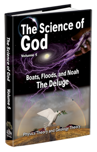
Volume 5 of The Science of God discusses the Biblical Flood account and if it is even possible as described. Flat Earth versus spherical Earth have somewhat different hydrodynamics that will affect the viablity of the two competing Earth models. Did the flood occur at all, and if so then what does that do to our understanding of Earth? Find out in this Volume of The Science of God.
AD
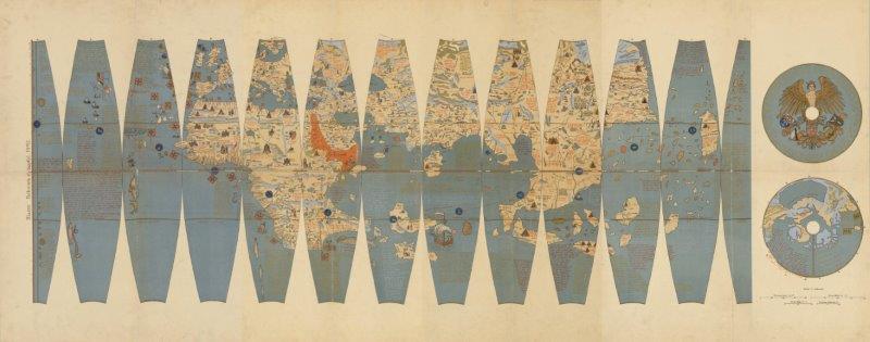
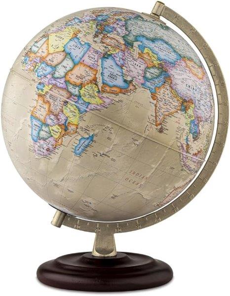
Oldest Existing Globe
(1492 Martin Behaim)
This is the oldest known globe map that still exists. It was made by Martin Behaim in 1492 shortly before the famous voyage Columbus embarked on August 3, 1492
Click here to download a printable PDF of the 1492 Martin Behaim Globe Map. You can print this 4-page map in portait orientation covering the full page. Cut out the pieces and attach them to a ball about
6 3/8 inches in diameter to see if the cartographer’s map works as a globe. If you are able to enlarge the images in the file to make the two circles on the last page to
print at 5 1/8 inches in diameter, then you can see how well it fits on a 12 inch globe or sphere.
14
Globe Concept
(150BC Greek philosopher Crates)
The Greek philosopher Crates from Mallus, Turkey is recorded as having the earliest mention of a globe
over 2,100 years ago.
(Additional Information about the Oldest Globe can be found here.)
This spherical map, typically referred to as a “globe”, is the most accurate of the maps shown on this page. It is used for navigation by sea, by air, and by land.
When measuring distances for travel, it is the only map that accurately measures in all directions. It also explains the season changes with its spin and unique tilt being opposite North from South.
However, this map has two terrible problems regarding convenience when traveling:
First, you cannot fold it up and place it in your pocket. And its second downfall that most other maps do not have, is that you cannot view all of it at the same time due to it being a sphere. So, in regard to trying to get the big picture at a glance,
maps 2 and 3 are more appropriate than this 3-dimensional map. Other than those negatives, so far, this map has been proving itself as the most accurate map design that is used around the world today.
15
Summary of Lesson 1
While these maps do not conclusively prove a spherical Earth or a flat Earth, all of the above maps, with the exception of maps 1, 6, and 7, appear to indicate that the cartographers believed that the Earth is spherical in form. This can be understood by reading their text printed on some of the maps,
and by all of the maps having meridian and parallel lines, and also by seeing the distortion/stretching of land mass in order to flatten each map into a visually and logically comprehendible form while trying to stay true to meridian and parallel lines. The only maps on this page that the cartographers
stated to be flat Earth maps, are maps 1, 6, and 7, all of which also have meridian and parallel lines.
Map 6 has a curved (concave) surface, and that shape helps it account for the varying sunlight angles during the seasons. Its concave form causes the seasons to be opposite of what is thought to be experienced with a
globe model based upon the Sun’s position relative to Earth. Regarding flat Earth, gravity is one point of contention where flat Earth proponent say that the water would not curve around a ball,
but rather it would level to a flat surface. This makes sense on a flat Earth model, but since map 6 is not flat, it presents a problem with that concept. Map 6 would require gravity or a force of some sort to keep the water curved to the contour shown in map 6.
- - - - - - - - - - - - - - - - - - - - - - - - - - - - - - - - - - - - - - - - - - - - - - - - - - - - - - - - - - - - - - - - - - - - - - - - - - - - - - - - - -
’
“ ”
100
7;13;1
0
rgba(000,000,000,1);
rgba(255,255,255,1);
rgba(255,255,255,1);
rgba(077,000,000,1);
rgba(255,100,100,1);
0px;
Yes;
pf;
1;
h0;
https://anchor.fm/s/fa959cc8/podcast/rss;
https://www.EverythingIsConnectedRL.com;
https://www.RLindemann.com/favicons/eicfavicons/EICFavIcon180.png;
https://www.RLindemann.com/?pge=30015-
www.russlindemann.com requires cookies and will not function properly without the use of cookies. Cookies are stored on your computer and are used to keep your cart contents in your cart and other similar purposes. If you do not want cookies from this site used then leave this site and delete any remaining cookies for www.russlindemann.com from your browser.